
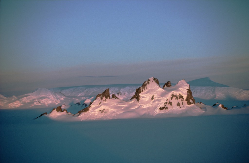
Rocks and fossils reveal how the world was back in deep time. They tell us of past hotter and colder climates, of cataclysmic events, and of the slow grind of the tectonic plates. They also map out the halting path, with its false starts and premature ends, that life has taken to get to where it is now. Less than one percent of Antarctica is free of ice and yet the continent contains some of the most spectacular mountain ranges anywhere in the world.
The Earth’s crust
The crust is the outermost layer making up the solid Earth. It is distinguished from the underlying mantle layer by its more silicon- and aluminium-rich composition, lower density, and the lower velocity at which it conducts seismic energy. Most of the crust can be classified either as ‘continental’ or ‘oceanic’ (see below). The crust beneath Antarctica is continental, but it is surrounded by the oceanic crust of the Southern Ocean.
Oceanic Crust
Oceanic crust underlies most of the two-thirds of the Earth’s surface which is covered by the oceans. It has a remarkably uniform composition (mostly 49% ± 2% SiO2) and thickness (mostly 7 ± 1 km). The ocean floor is the most dynamic part of the Earth’s surface. As a result, no part of the oceanic crust existing today is more than 200 million years old, which is less than 5% of the age of the Earth itself. New oceanic crust is constantly being generated from the upper mantle by sea-floor spreading at mid-ocean ridges, while other parts of the oceanic crust are being recycled back into the mantle at subduction zones. Maps of oceanic crustal ages have been produced as a result of studies of the record of reversals of the Earth’s magnetic field, which are preserved in the crust as it forms.
Continental Crust
Continental crust is more silica-rich and thicker than oceanic crust, and by virtue of generally surviving longer, is on average older. The average thickness of the continental crust is about 40km, but beneath parts of the Andes and the Himalaya mountain ranges the crust is more than 70km thick. The oldest parts of the continental crust, known as ‘shields’ or ‘cratons’, include some rocks that are nearly 4 billion years old. Most of the rest of the continental crust consists of the roots of mountain belts, known as ‘orogens’, formed at different stages in Earth history. Over large areas, however, these orogens are covered by younger sedimentary rocks.
Ironically, new continental crust is produced by the destruction of oceanic crust at subduction zones, a process that continues today. Continental crust is not immortal, however, it is continuously being eroded and turned into sediment. Some of this sediment ends up on the ocean floor where it can be returned to the mantle at subduction zones.
Beneath the Crust
Beneath the crust lies the mantle, a thick dense layer that extends 2,700km down to the Earth’s outer core. The boundary between the crust and the mantle is known as the ‘Mohoroviçic discontinuity’, or ‘moho’, after the seismologist who first discovered it. Contrary to popular myth, the mantle material beneath the moho is not generally molten or even partially molten. The mantle only becomes partially molten in special circumstances such as occur at mid-ocean ridges, subduction zones or ‘hotspots’.
The crust is firmly attached to the uppermost part of the mantle and together they make up a rigid layer known as the ‘lithosphere’. The rigid surface of the Earth is made up of ‘plates’ of lithosphere which move relative to one another and relative to the underlying part of the mantle, known as the ‘asthenosphere’. The asthenosphere is also solid, but over millions of years it deforms in a manner similar to plasticine (although it is actually many times more viscous).
Hotspots are areas of the Earth’s surface, away from tectonic plate boundaries, that have a high rate of basaltic volcanism. They are thought to be underlain by hot plumes of mantle material rising from deep within the Earth. Hotspots are responsible for the volcanic activity we see in Hawaii and Iceland today and have been implicated in the break-up of continents in the past.
Nunataks
Nunataks are small areas of rock emerging above ice sheets and glaciers. They are isolated from the main mountains and are often easier to access. This makes them particularly useful to geologists.
Dry valleys
Dry valleys in Antarctica are areas of extensive and exceptional rock exposure. Thanks to local or regional weather patterns, even glaciers fail to invade the rocky landscapes. They are also known as Antarctic ‘oases’ and are best developed in the McMurdo area of East Antarctica. Unlike the fertile oases of hot deserts these represent some of the coldest and driest places on our planet.
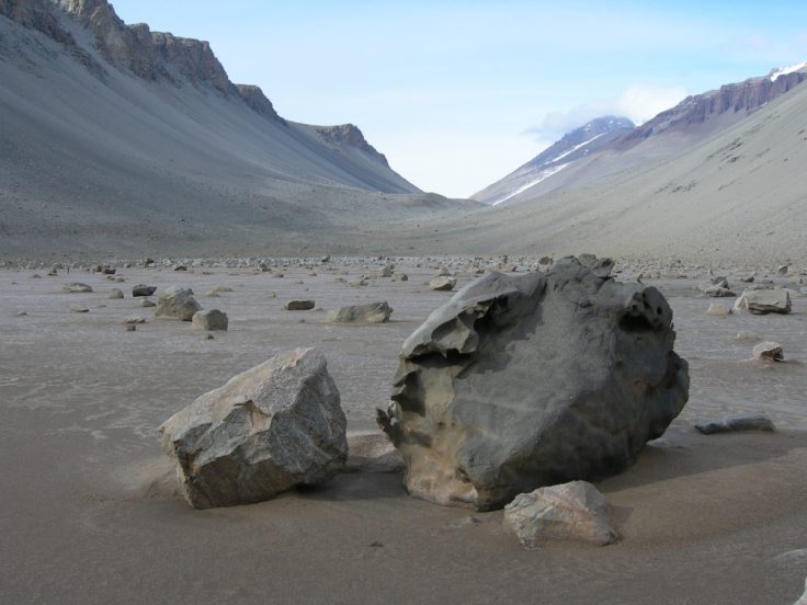
Throughout Antarctica, ice-free areas like these enable geologists to collect the rock samples and fossils of ancient life which provide them with windows on the multi-million-year history of Antarctica.
Volcanoes
The exposures of rock in Antarctica tell stories of an ancient continental shield, of volcanic activity and the injection of enormous bodies of hot magma (molten rock) into the crust, and of massive forces deep within the crust deforming and metamorphosing (changing) earlier rock formations.
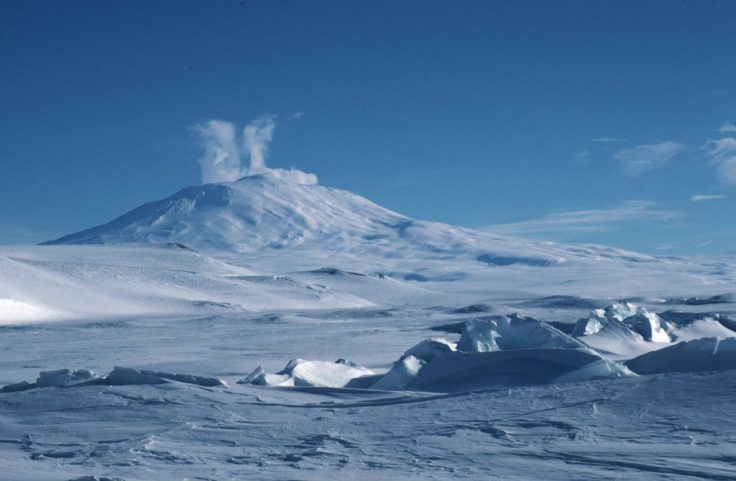
Volcanoes are an important component of the Antarctic region. They formed in diverse tectonic settings, mainly as a result of mantle plumes acting on the stationary Antarctic plate. The region also includes amongst the world’s best examples of a long-lived continental margin arc (Antarctic Peninsula), a very young marginal basin (Bransfield Strait) and an oceanic island arc (South Sandwich Islands). Many extinct volcanoes are very well preserved and others are still active (e.g. Deception Island, Mount Erebus, and the South Sandwich Islands).
Volcanic eruptions were common during the past 25 million years, and coincided with the great period of climatic deterioration that resulted in the formation of the Antarctic ice sheet. Many of the volcanoes show the effects of interaction with ice. BAS has played a major role in describing these effects and modelling their influences on the resulting volcanic sequences. We need to describe and understand these interactions in geologically recent times in order to predict future configurations of the ice sheet and its role in the global system.