pp2txt.out.f
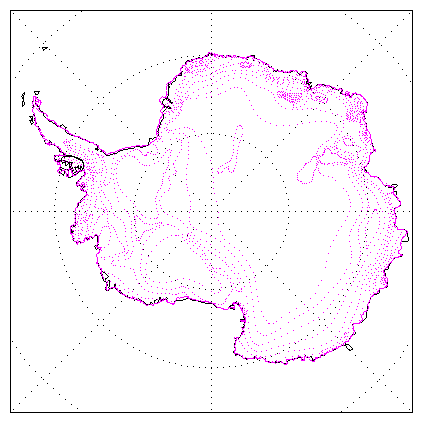
Climate information for Antarctica
This page will be a repository for useful climate datasets for Antarctica.
For now, I have some accumulation datasets.
If you are interested in weather data for Antarctica, see Metlog.
This is not really very general-public-y. If you don't recognise the terminology,
you probably don't want the dataset...
COntents:
- Accumulation
- Temperature
- Seaice (from SEALION / S Kern)
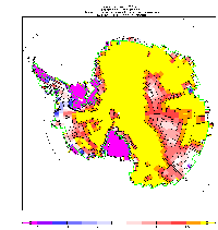
Accumulation
There are 5 datasets here. I drew the pictures.
Some of these datasets are also available as PP-format - contact me if you might be interested.
- dgv-digit-values.txt is an ascii file of values that
David Vaughan
ditigised from the Giovinetto and Bentley map. File format: longitude latitude value; values are in kg/m2/year.
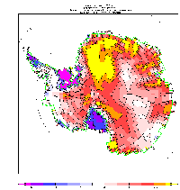
- cg-global-acc.txt is an ascii file on a global
regular grid from Christophe Genthon at LGGE Grenoble
with values from ECMWF analyses (1985-1991) over most of the globe
(as P-E); and digitised from Ohmura over Greenland and the abovesaid G+B over Antarctica.
File format: header line, then value\nvalue\n... Grid is 90,89,...,-90 in latitude and -179.5,178.5...180 in longitude.
- wmc-ant-acc.txt G+B ascii again, digitised by WMC
from the dataset of DGV (item 1 above) and converted onto a regular
grid, for Antarctica only. File format: triples of lat lon value; value in kg/m2/year.
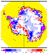
- Number 4 isn't really mine, its David Vaughans: his new compilation of Antarctic accumulation, blending
observations with SSMI stuff from Zwally: dgv/surfbal.htm.
This is my picture from his dataset; his may be slightly different (and more definitive).
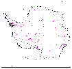
- dgv-wmc-sorted.dat is a colletion of observations compiled by DGV.
It has 1644 points in it (depending on version...).
Here is a picture of it; if you want the dataset itself you'll have to ask
d.vaughan@bas.ac.uk. He is very happy to give it
out, but wants to know who has it.
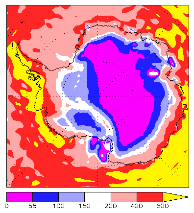
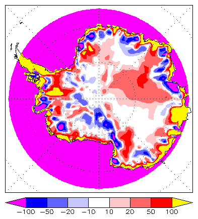
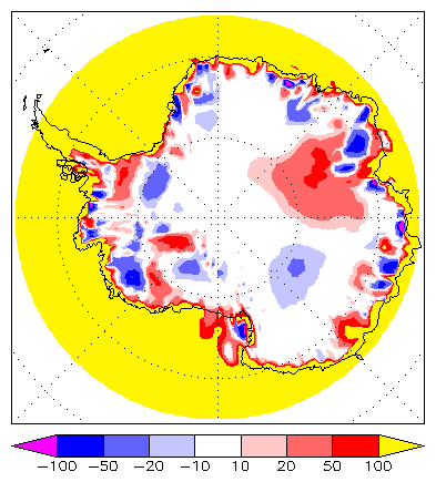
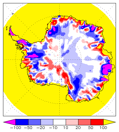
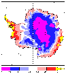
Datasets 2, 3 and 4 can be differenced: here they are:
| 4 - 3 (DGV - WMC) |
2 - 3 (CG - WMC) |
2 - 4 (CG - DGV) |
 |
 |
 |
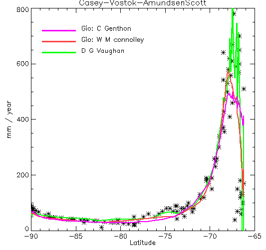
One can also compare the datasets along a traverse line, in this case from Casey to Vostok
to Amundsen-Scott. The crosses are data points from
DGV (dataset 5 in the list above) selected to be on the
traverse line. The lines are datasets 2, 3 and 4 interpolated to the dataset
5 locations.
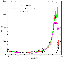
Looking at this, what do we see? DGV captures the high accumulation just
near the coast best - although this is a difficult area, because there are low-accumulation
places at the same latitudes. In general, the gridded datasets cannot be expected to resolve the
coastal areas well, and don't. I had expected WMC and CG to look more similar than they do in the interior -
since they are digitised from the same map!
Polewards of 80 S WMC and CG agree, and DGV is somewhat higher: in terms of matching the observations
it is hard to choose between them.
Between 80 S and 75 S WMC, CG and DGV disagree; DGV has the edge nearer 75 S and CG nearer 80 S.
Between 75 S and say 69 S all three agree well enough
with the observations.
North of 69 S, CG and WMC miss the accumulation peak the DGV captures.
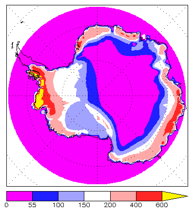
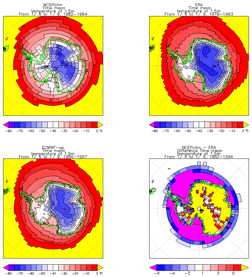
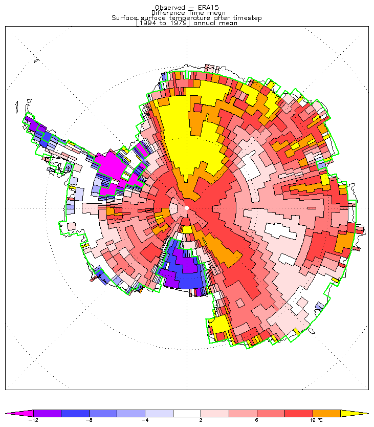
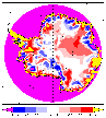
Temperature
Please note that none of the temperature maps below are definitively reliable.
In particular the analyses are known to have large flaws.
These are from analyses (and below, regridded from "observations"). They are:
    NMC (NCEP/NCAR)         ERA

    ECMWF operational       NMC-ERA
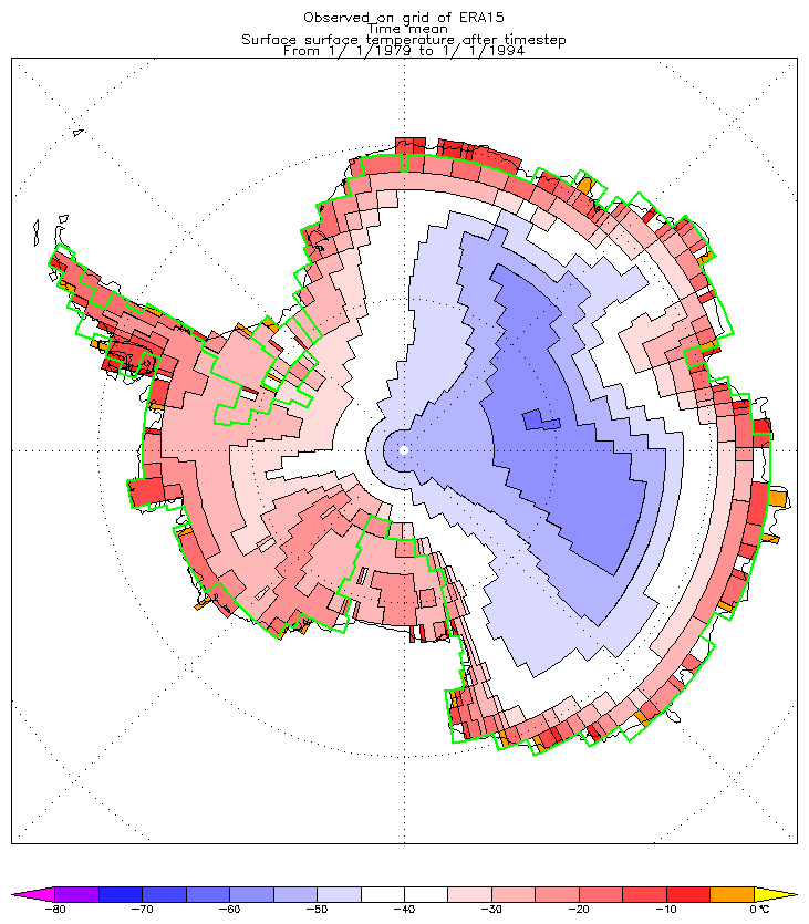
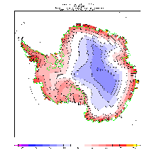
And here is ERA, annual mean:

The data used for this is available here.
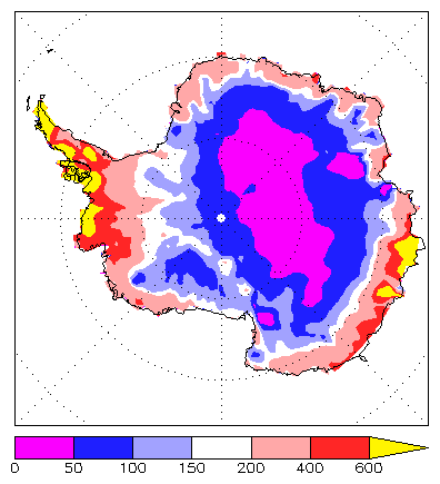
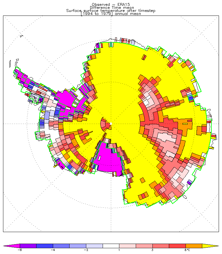
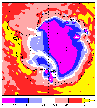
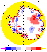
Here is the temperature, regridded from Giovinetto and Bentley (exact ref...?),
the difference from ERA, and the difference with expanded contour range.
The data used (in pp-format) is g_and_b.t.pp.